A shelter count for the months between registration sweeps.
Refugee Camp Mapping counts the shelters in your camp from a monthly very-high-resolution pass and draws this month's boundary over last month's. You plan caseload and rations against something dated this month, not the last exercise.
Between two registration sweeps
The caseload you work from is the last registration or verification exercise, split by sector. Then the arrivals carry on. New shelters go up along the edge of the site, a sector that was full spills into the next block, and the site planner is allocating plots faster than the database is catching up. The food partner asks for a planning figure for the next distribution cycle, and you give them one. You walk the new blocks, you ask the planner how many plots have gone out, you remember what the last sweep said. It is a judgement call, and everyone in the room knows it.
Nobody is being careless. A full exercise takes enrolment staff, time on the ground and a reason to run it, and the camp doesn't stand still while it is organised. So ration planning and site planning lean on a figure that is already behind the ground when the meeting starts, and the sitrep carries it forward.
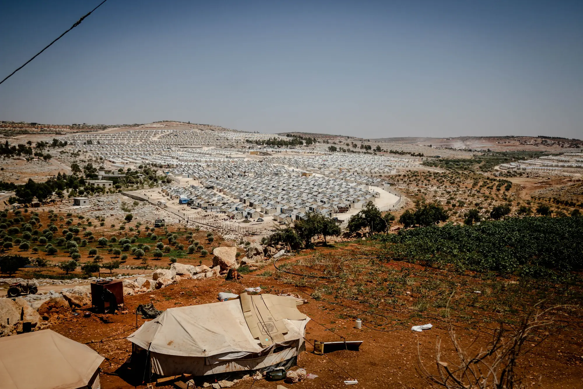
A monthly pass changes one thing. Each month there is a dated count of shelters by sector and a boundary showing how far the settlement has spread. Registration is still the record of who lives there. The count tells you where the ground has moved since, so you know which sectors to question.
What arrives each month
One set of files per monthly pass, in formats your GIS and planning sheets already open.
2.1GeoJSON
Shelter-count layer
A dated point layer of shelters, with a count for each sector of your camp. You bring it to the ration planning meeting beside the last registration figure and see which sectors have grown.
2.2GeoJSON
Footprint-change map
This month's camp boundary against last month's, with the area of settlement in hectares. Where the line has moved outward, that is where the site planner needs to look first.
2.3CSV
Counts and area as a table
Shelter counts and boundary area, joinable by sector or by date. It opens in the spreadsheet your distribution planning already lives in.
2.4Pass note
A note on each pass
The date of the imagery, and any part of the camp that sat under cloud and is still on the earlier reading.
How it works
Before the first pass
Send the camp boundary
Give us the outline of the camp or settlement, and your sectors if you want the count broken out by them.
Each month
A monthly pass is taken
We task a very-high-resolution pass over the area. If cloud covers the camp, the pass is skipped and we wait for the next clear one.
Each month
Shelters counted, boundary compared
Shelter structures are detected and counted, and the footprint is set against the previous month's.
Each month
The layer comes back
The count layer, footprint map, CSV and pass note, ahead of the next ration planning meeting where the pass allows.
Beside the last sweep
Use the monthly count as a check on the last registration figure, sector by sector. Where the count and the database agree, carry on. Where a sector has outgrown its last figure, that is a reason to ask for a verification there. The count never replaces registration, and it doesn't turn shelters into people for you.
Limits
- L1Cloud can delay a month
- The imagery is optical. A cloudy pass is skipped and the count waits for the next clear one, so a poor-weather month can slip. Monthly is a target, and we can't promise a delivery date against the weather.
- L2It counts structures
- The layer counts shelters. It cannot tell an occupied shelter from an empty one, how many people sleep in one, or who they are. Turning a shelter count into caseload is your assumption to make, and yours to defend.
- L3Resolution sets the floor
- At 0.5 m a pixel is half a metre across. A tent or hut a few metres wide is resolved. Small outbuildings, shelters packed wall to wall or those under trees may be merged or missed.
- L4No accuracy figure
- We don't publish an accuracy percentage for the count. Check the first months against your own ground count in a sector you know.
Who it's for
Use it if
- You manage a camp or settlement that is still growing and plan caseload or rations between registration exercises.
- You do site planning and need to see where the boundary has extended and by how much.
Don't use it if
- You need to know who is in the camp. This is a count of structures, not a registry, and it never tracks individuals.
- You want a replacement for registration or a census.
- You need to know whether a shelter is occupied.
- You need a count on a particular day. It runs once a month.
Questions from camp management
Does this replace registration?
No. Registration remains the record of individuals. This is a check between sweeps, to show where the camp has changed.
What if the month is cloudy?
The pass is skipped and the count waits for the next clear one. In a poor-weather month the cadence can slip, and the pass note says which parts of the camp are on older imagery.
Does it tell occupied shelters from empty ones?
No. It counts shelter structures, nothing about who is inside.
How accurate is the count?
We don't quote an accuracy percentage. The sensible check is to set the count against your own ground count for a sector you know well, in the first months.
Does it track people?
No. It counts structures and draws a boundary. There are no individual-level records and nothing biometric.
How do we get from shelters to caseload?
That step is yours. You apply your own assumptions, set the result beside the registration figure and use the sector count to see where the two have drifted.
Can it go into our GIS and planning sheets?
You get GeoJSON for a GIS and a CSV for a spreadsheet. There is no direct integration with a registration system.
Who owns the layers and what can we share?
What you may do with the output files, and the licence on the imagery behind them, is written into the agreement before the first pass.
How is it priced?
It depends on the size of the camp and how many months you want, so we quote once we've seen the area. There is no price list on this page.
Get a monthly shelter count.
Send the outline of your camp, and your sectors if you have them. We'll set up the monthly pass from there.
Get started